
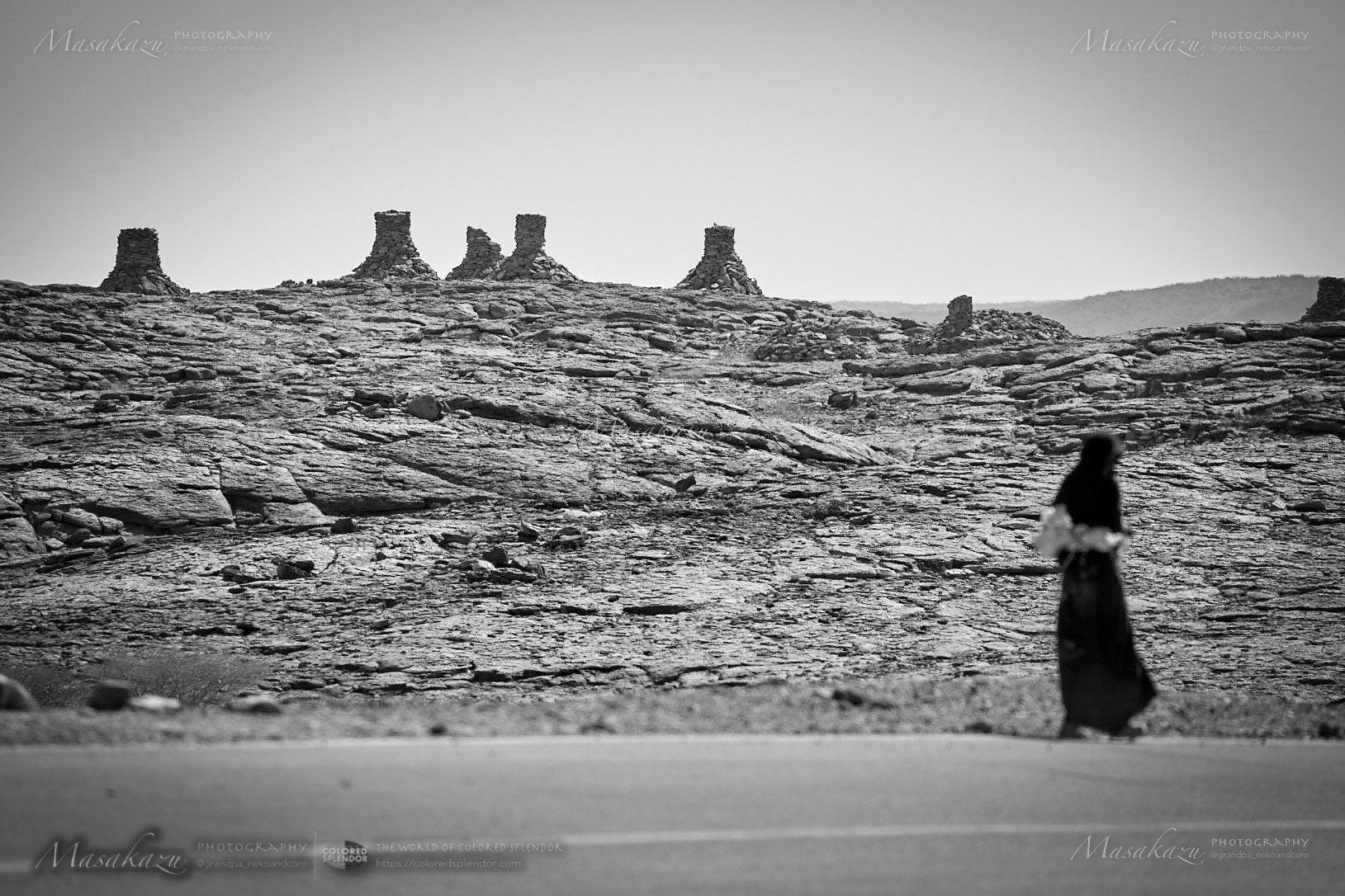
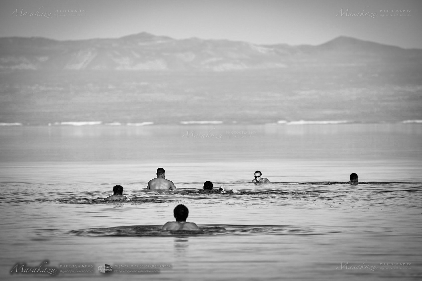
Lake Afrera
<Series 6 : Lake Afrera >
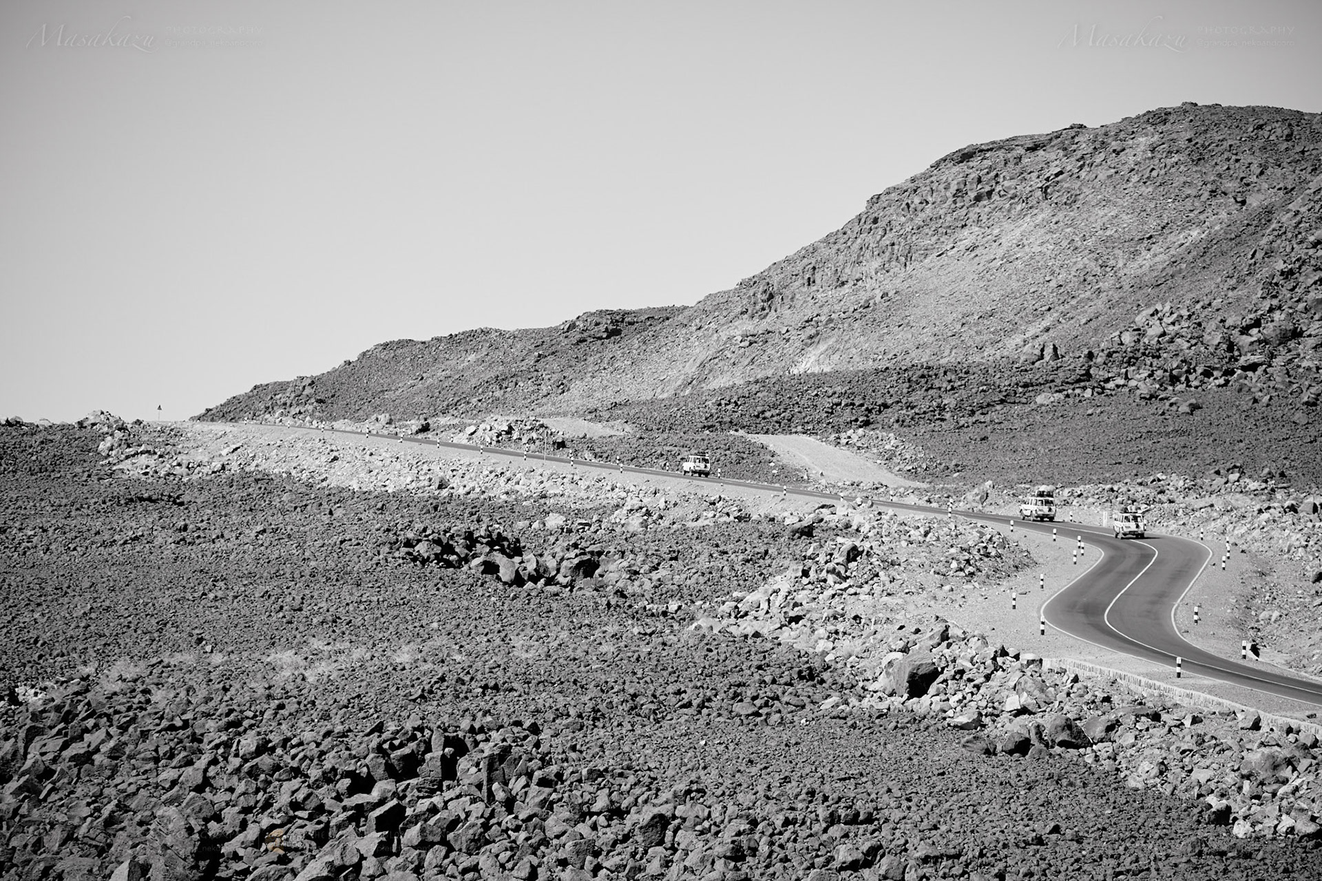
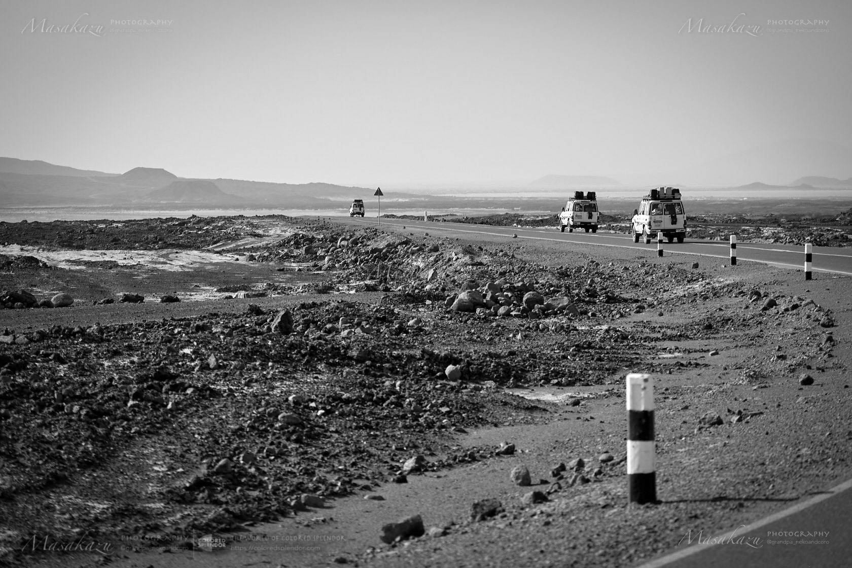
Leaving the town of Bati, we headed toward Semera: Bati's elevation is 1502 meters above sea level, between the Abyssinian Highlands and the Great Rift Valley. Semera, the capital of Afar, has an altitude of 420 meters above sea level and has a desert climate with a maximum temperature of 39°C during the dry season.
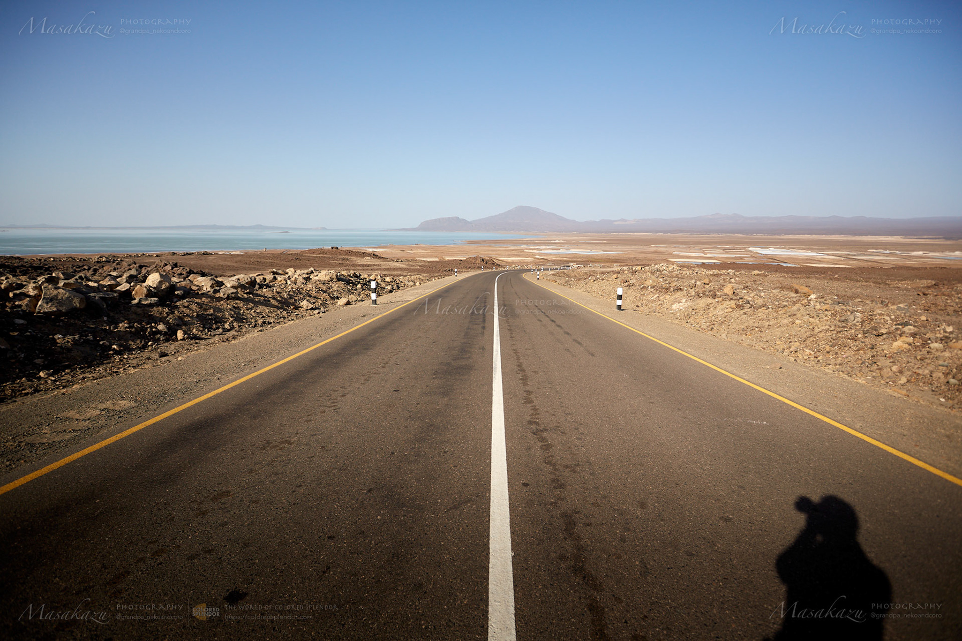
The asphalt on the road leading to Semera was stripped off in places, so even a driver with a sturdy 4WD had to drive carefully to avoid bursting the tires. After a while, the car suddenly slowed down.
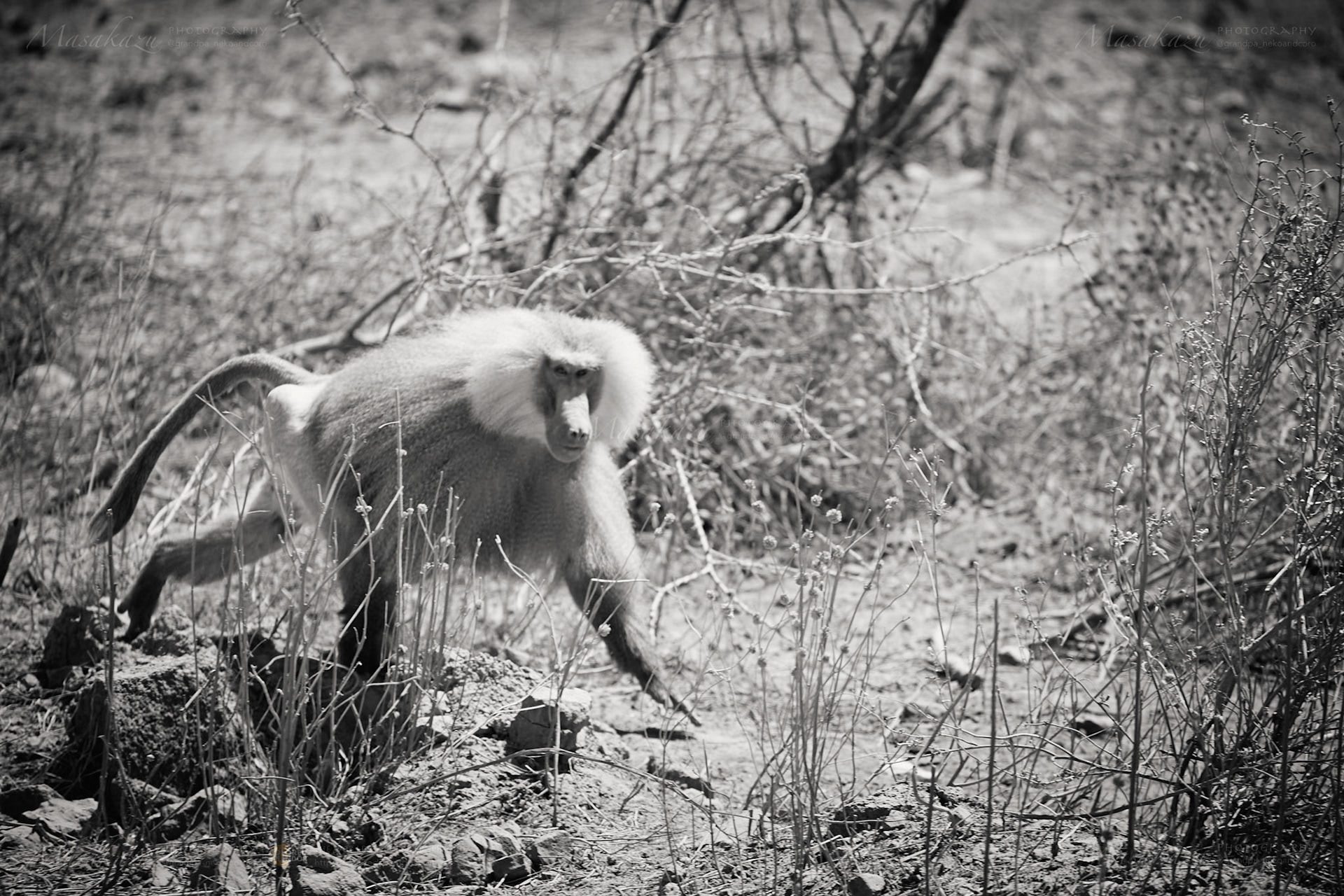
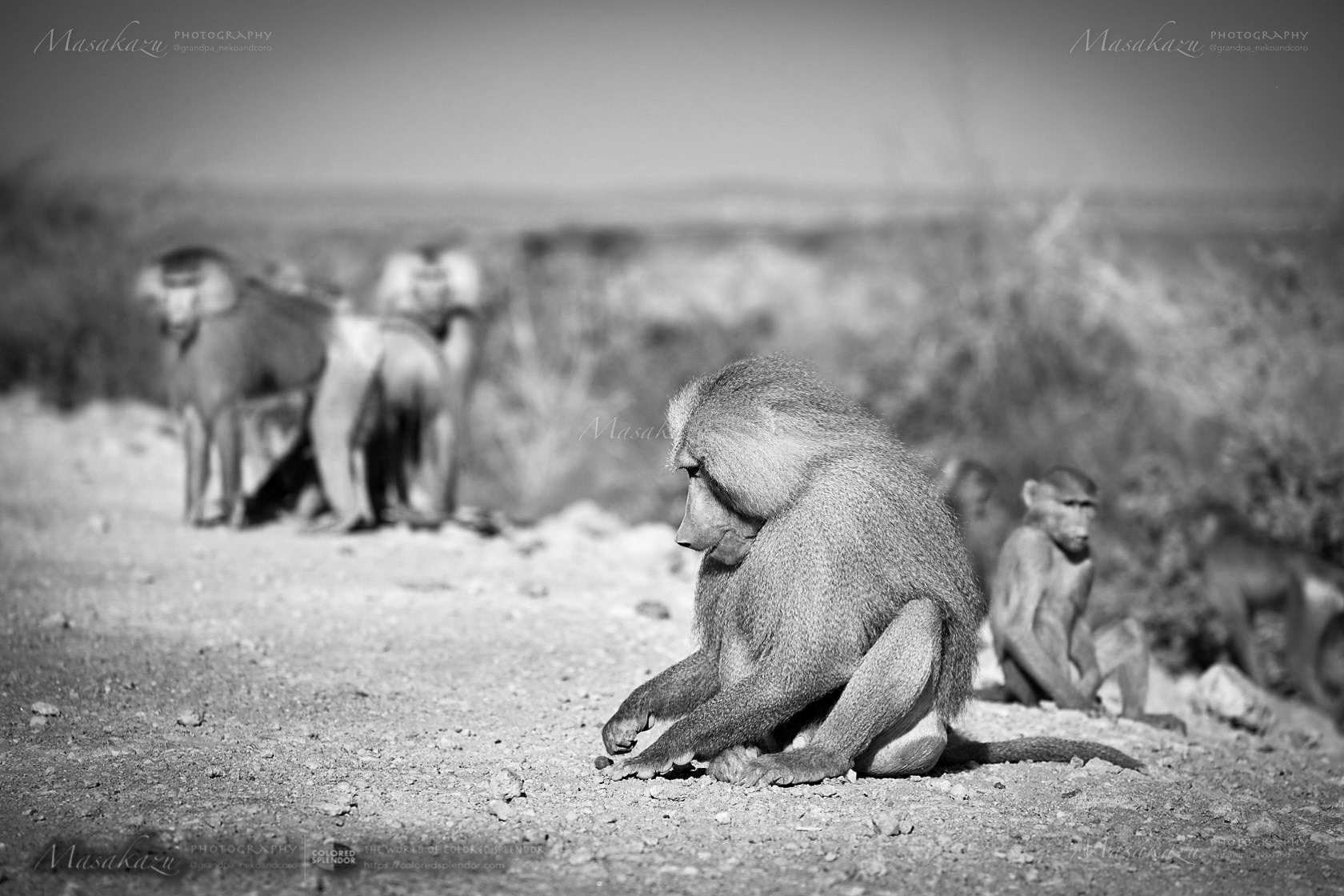
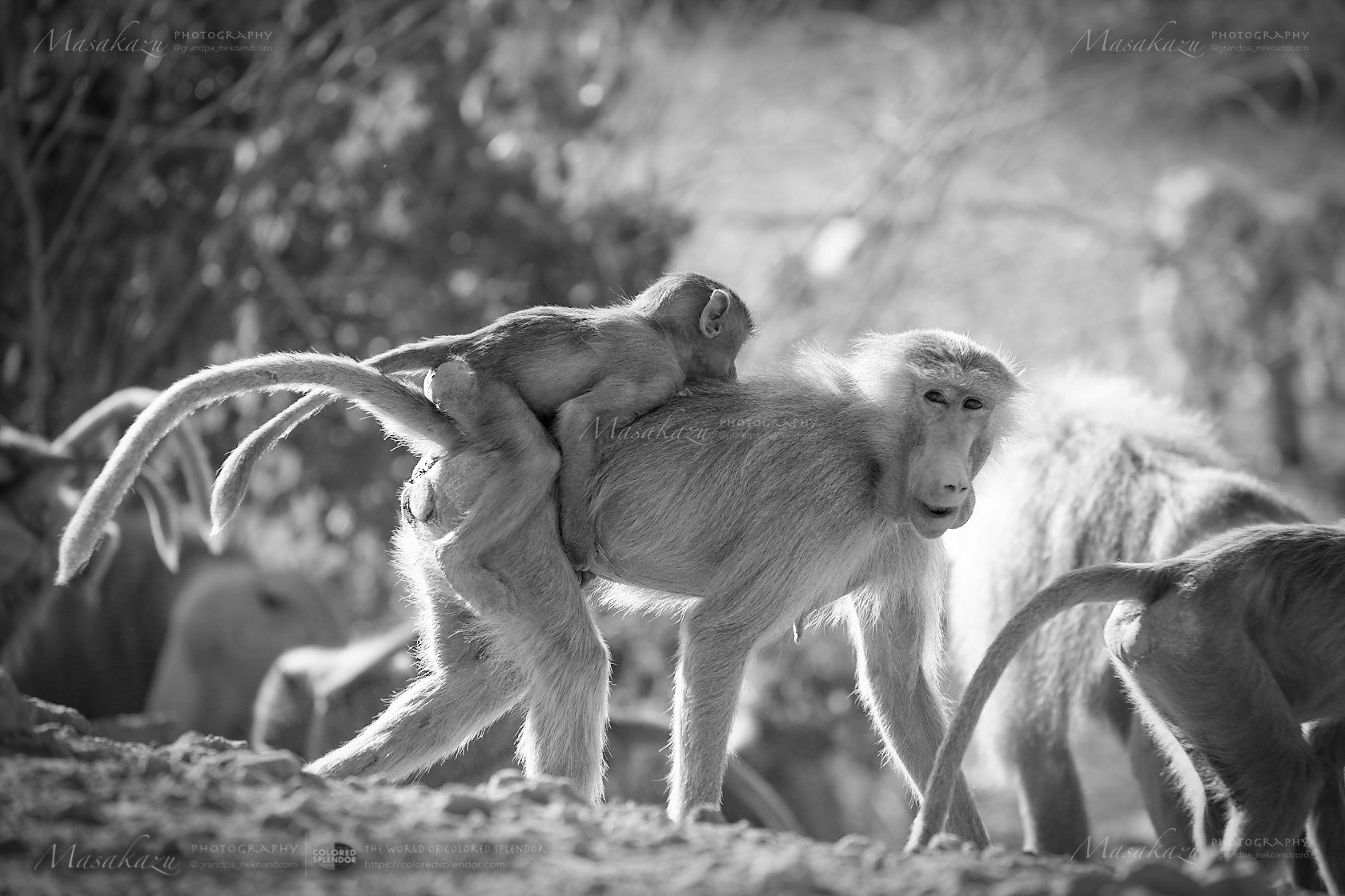
Dozens of baboons (Hamadryas baboon) had flocked along the road. The guide said, "The baboons who have learned the taste of human food have gathered because the drivers who come and go on the road give food leftovers."
Dozens of baboons (Hamadryas baboon) had flocked along the road. The guide said, "The baboons who have learned the taste of human food have gathered because the drivers who come and go on the road give food leftovers."
Location: Administrative Zone 2 of the Afar Region, Ethiopia, February 2015
For more information: https://en.wikipedia.org/wiki/Lake_Afrera
Equipment: Canon EOS 5D markⅢ; Canon EF 24-70mm f/2.8l Ⅱ USM; Capture One 20; Adobe Photoshop Lightroom
For more information: https://en.wikipedia.org/wiki/Lake_Afrera
Equipment: Canon EOS 5D markⅢ; Canon EF 24-70mm f/2.8l Ⅱ USM; Capture One 20; Adobe Photoshop Lightroom
☘️
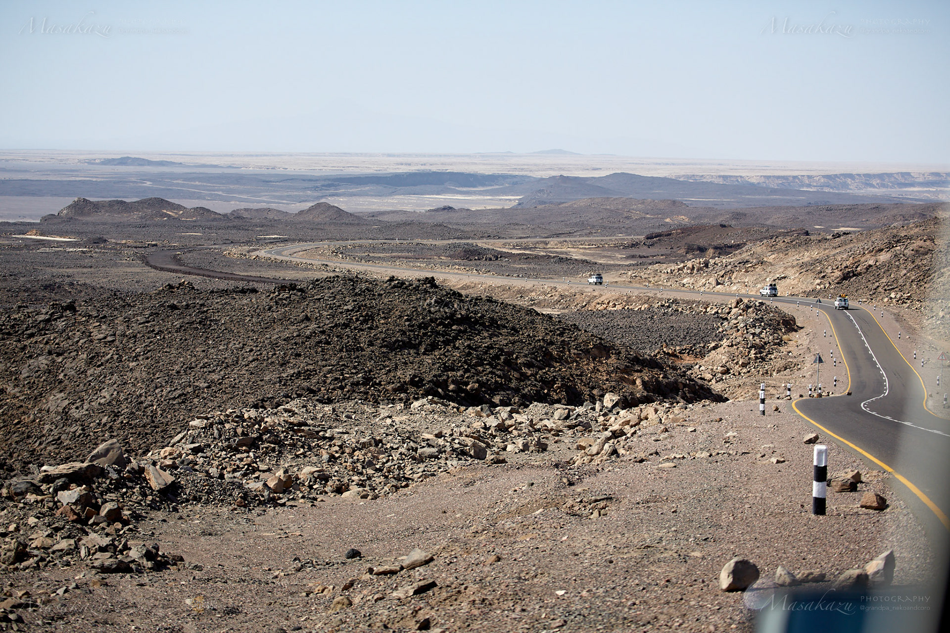
Eventually, the road gradually descended into an arc and became a vast landscape where Lava plateau spread all over.
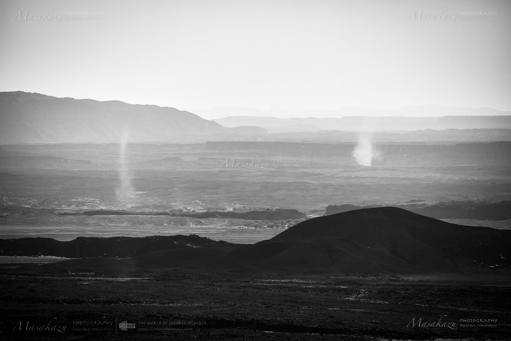
In the distance, I could see a tornado streaking from the ground and the vast Lake Afrera with a minimum elevation above -100 meters. The outside temperature of the car was already above 40°C.
☘️
☘️
Colletion>
Title: To Afar Triangle in Ethiopia: one of the harshest places on Earth
A new adventure has begun; to meet the harshest nature on earth; to meet the lives of Ethiopian peoples living in the harshest places.
In 1974, several hundred pieces of fossilized human bones more than 3 million years old were found near the village of Hadar, Ethiopia, and it was found to be a female skeleton of Australopithecus afarensis, and she was named "Lucy".
The broad-leaved forests that provided fruits: Lucy's main foods, had decreased drastically with the advent of the Sahara Desert and the Great Rift Valley, which began forming about 10 million years ago; it was necessary to descend to the ground and move between the trees to obtain the fruits.
The Afar Triangle, or Afar Depression(as known as the Danakil Desert), located in northeastern Ethiopia, was said to be one of the harshest places on earth and was formed by the Great Rift Valley. In the Danakil Desert, the lowest elevation is below -100m above sea level and the dry season temperature is close to 50°C; surprisingly, this is the place where the Afar peoples live, besides, this place is a region with extremely active uplift: the volcano Dallol, which has the crater in the lowest place in the world on land: the volcano Elta Are, which has a low-viscosity lava lake.
☘️
You can buy this series photo at Adobe stock >>
Thank you for your interest
☘️🔗 My Portfolio 🔗☘️
☘️🔗 My Portfolio 🔗☘️
Behance |
Adobe Stock | #ethiopia
Instagram| @grandpa_nekoandcoro
Photography by Masakazu